stud
bud
Sign up
Log in
Home
Library
Explore
SAT
More
A Spatial Way of Thinking Flashcards | StudBud
Explore
/
A Spatial Way of Thinking
A Spatial Way of Thinking
31 terms
·
StudBud Administration
·
542 plays
Unit 2 TCI
Flashcards
31 cards
F
Practice quiz
P
Host live
L
Questions
31
Answers
1
Which physical feature is the red Question Mark "?" sitting on?
plateau
island
basin
peninsula
2
Why does the photo represents human-environment interaction?
The child is wearing warm clothing in the cold weather.
The child is smiling & happy to play in the snow.
The child's lives near a northern, arctic region.
The child's clothing is bought from a regional store.
3
Which physical feature is the red Question Mark "?" pointing at?
plateau
volcano
mountain
isthmus
4
What kind of housing would you find most often in an area with a very high population density?
small apartments in skyscrapers
large homes with front and back yards
houses surrounded by farm fields
individual homes spaced miles apart
5
Which physical feature is the red Question Mark "?" pointing at?
delta
river
volcano
isthmus
6
Which of the following will you find on physical features map?
trade & manufacturing
landforms & water bodies
temperature & precipitation
trees & other plants
7
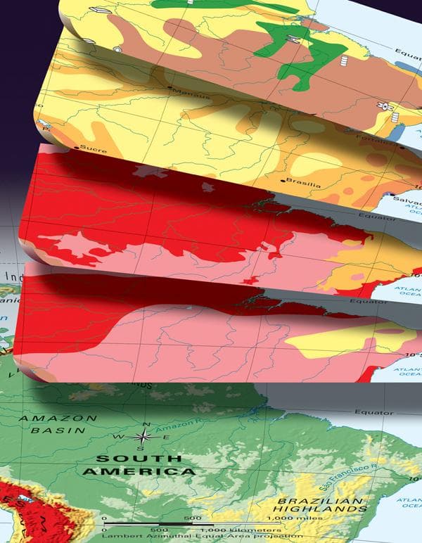
What kind of information is shown on this map?
vegetation
economic activity
physical features
climate zones
8
Which physical feature is the red Question Mark "?" pointing at?
delta
strait
isthmus
plateau
9
What mystery did John Snow solve in 1854 by thinking like a geographer?
bubonic plague spread through the bites of infected fleas
how cholera spread through polluted drinking water
tuberculosis spread through the coughs and sneezes
how diphtheria spread through direct physical contact
10
Which of the following would you find on a climate map?
natural resources
average precipitation
land use
vegetation
11
More than half of the land in Africa is used for subsistence farming, in which
farmers grow only enough crops to feed their own families.
farmers raise crops or livestock to sell.
farms are owned by large multinational corporations.
farmers must move around to find food & water for animals.
12
Identify the kind of information shown on this map of North Africa?
population density
vegetation zones
economic activity
climate zones
13
Pattern of weather over a long period of time
weather
temperature
precipitation
climate
14
What are coal, iron, uranium, and petroleum?
natural resources
economic activity
land uses
vegetation
15
Which type of information is found on an economic activity map?
where its people live
how high mountains are
how its people make a living
what type of climate it has
16
Which economic activity is linked to the natural resources of the area?
the aircraft industry in Seattle, Washington
the fishing industry in Gloucester, Massachusetts
the insurance industry in Hartford, Connecticut
the banking industry in Chicago, Illinois
17
One example of a thematic map that shows human geography is
a map showing the climate zones in Alaska.
map showing ravines & streams in Finger Lakes Nat'l Forest .
map showing the cholera deaths near Broad St pump in London.
a map showing the vegetation of Yosemite National Park.
18
A map that shows climate is a type of
vegetation map
thematic map
climate map
physical features map
19
Which physical feature is the red Question Mark "?" sitting on?
volcano
mountain
plateau
canyon
20
Small farmers grow crops to feed their own families
livestock raising
subsistence farming
slash and burn farming
commercial farming
21
What shows the average temperature and precipitation in a place over a year?
a map legend
thematic map
a physical map
a climagraph
22
Which physical feature is the red Question Mark "?" pointing at?
gulf
lake
basin
river
23
Any action that relates to the making, buying, and selling of goods and services
physical activity
land use
economic activity
farming activity
24
area defined by natural or cultural characteristics that set it apart from other areas
a continent
a landform
a region
a city
25
Which physical feature is the red Question Mark "?" sitting on?
peninsula
river
gulf
lake
26
Which map shows how crowded a country is?
economic activity map
climate map
physical features map
population density map
27
Identify the kind of information about Nome, Alaska shown on this graph.
economic activity
climate patterns
physical features
vegetation zones
28
A physical map may include such features as
natural resources.
population density.
economic activity.
landforms and bodies of water.
29
One of the most densely populated places on Earth is
Waltham, Vermont.
Avoca, Ireland.
Skwentna, Alaska.
Dhaka, Bangladesh.
30
Which physical feature is the red Question Mark "?" pointing at?
mountain
peninsula
delta
canyon
31
What is an area that has similar characteristics such as Latin America?
place
region
climate
resource