stud
bud
Sign up
Log in
Home
Library
Explore
SAT
More
World Geography Flashcards | StudBud
Explore
/
World Geography
World Geography
20 terms
·
StudBud Administration
·
477 plays
Continents, Oceans, maps, and longitude and latitude.
Flashcards
20 cards
F
Practice quiz
P
Host live
L
Questions
20
Answers
1
What are the imaginary lines running vertically that help us measure east and west?
Longitude
straight
Latitude
Equator
2
What is the equator?
Imaginary line separating Northern and Southern hemispheres
Something to help us tell time by
Imaginary line separating Western and Eastern hemispheres
A line painted across Africa
3
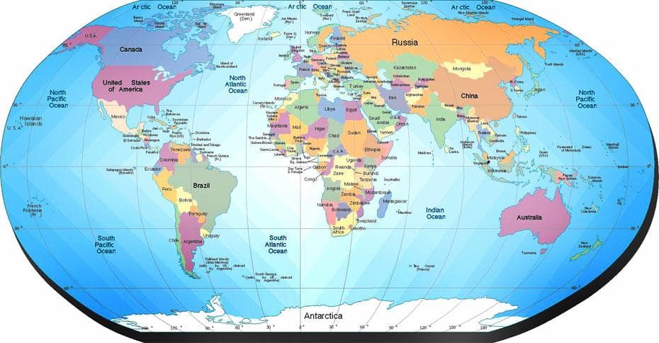
What would a physical map show?
weather
country boundaries
population
landforms
4
What are the coordinates for letter C?
120° W 30° S
0° 150° W
60° N 60° E
60° N 120° W
5
What two continents are completely in the Northern hemisphere?
North America and Europe
Africa and South America
North America and Greenland
Australia and Europe
6
What is the largest continent?
Iceland
Australia
Africa
Asia
7
What continent is completely in the Southern hemisphere?
Asia
North America
Africa
Antarctica
8
What letter is on 60° N and 120° W?
H
B
I
E
9
What ocean surrounds the North Pole?
South Ocean
Pacific Ocean
Indian Ocean
Arctic Ocean
10
What continent is also a country?
North America
Mexico
Europe
Australia
11
What trade route is shown here?
Western European Trade Route
The Silk Road
Trans-Saharan Trade Route
Sub-African Trade Route
12
What trade route is this?
Silk Road
Trans-Atlantic Trade
Northwest Passage
Hanseatic League
13
What ocean is between North America and Europe?
South Ocean
Pacific Ocean
Atlantic Ocean
Indian Ocean
14
What continents does the Prime Meridian run through?
Australia and Asia
Asia and Antarctica
North America and South America
Africa and Europe
15
What continent is this?
South America
Antarctica
North America
China
16
What trade route is this?
Trans-Atlantic
Indian Ocean Basin
Silk Road
Hanseatic League
17
What are the imaginary lines running horizontally that help us measure north to south?
curved
Longitude
Latitude
Prime Meridian
18
What would a political map show?
animals
rivers
cities
mountains
19
What continent is this?
Antarctica
Asia
Greenland
Africa
20
What continent is this?
Europe
South America
North America
Antarctica