stud
bud
Sign up
Log in
Home
Library
Explore
SAT
More
Geography Review Flashcards | StudBud
Explore
/
Geography Review
Geography Review
30 terms
·
StudBud Administration
·
736 plays
Geography Unit
Flashcards
30 cards
F
Practice quiz
P
Host live
L
Questions
30
Answers
1
Meridians of longitude run from...
East to West
Up and down
North to South
Side to side
2
Which continent is shown at number 4?
Australia
Europe
Africa
South America
3
Served as arteries for farms and industries.
St. Lawrence River and the Great Lakes
Rio Grande and Gulf of Mexico
Missouri and Mississippi River
Ohio and Colorado River
4
This is parts of a sea or ocean surrounded by land
Gulfs and Bays
Great Lakes
Ocean
Tributaries
5
Explored by Lewis and Clark
Atlantic Ocean
Ohio River
Columbia River
Colorado River
6
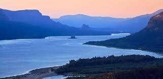
What geographic feature is seen in this picture?
Oceans
Plains
Mountains
hills
7
This was an early exploration route for the French and Spanish.
Colorado River
Pacific Ocean
Gulf of Mexico
Atlantic Ocean
8
__________ was the highway for explorers, early settlers,and later Immigrants
Pacific Ocean
Atlantic Ocean
Ohio River
Gulf of Mexico
9
This region has some of the oldest rock formations in North America?
Mississippi River
Canadian Shield
Coastal Plains
Appalachian Highlands
10
I flow into larger rivers
Rivers
Tributaries
Lakes
Streams
11
Which continent is shown by the number 6?
North America
Africa
Europe
Canadian Shield
12
This feature flows into a larger body of water
River
Tributary
Ocean
Lake
13
The continents of Europe and Asia make up?
Eurasia
Pangea
Asourpe
Antartica
14
Large land masses (smaller than a continent) surrounded by water are?
Peninsulas
Islands
Plateaus
Continents
15
The Continental divide decides...
How deep rivers are
How could rivers are
The directional flow of rivers
How fast rivers flow
16
Parallels of latitude run from...
North to South
East to West
Up and down
Left to Right
17
Contains fertile soil and mountains
Coastal Plain
Coastal Range
Canadian Shield
Appalachian highlands
18
What continent is number 2 on?
South America
Australia
Antartica
Europe
19
Continents are...
Europe and Asia together
Large land masses surrounded by water
Islands in the Caribbean
Countries in Africa
20
Old eroded mountains are found in this region...
Appalachian Highlands
Rocky Mountains
Canadian Shield
Interior Lowlands
21
This makes the border between the United States and Mexico
Mississippi River
Columbia River
Rio Grande
Ohio River
22
Which one of these is not one of our five oceans?
Hudson
Atlantic
Indian
Southern
23
Mountains are...
surrounded by water on three sides
Landforms that extend above the surrounding area
large land masses surrounded by water
Vast, flat land
24
I'm surrounded by water on three sides.
Peninsula
Country
Island
Continent
25
Which region is shown in the picture?
Interior Lowlands
Great Plains
Rocky Mountains
Coastal Range
26
This geographic feature is an elevated area but smaller than a mountain.
Plains
Hill
Plateau
Mountains
27
Who explored the Colorado river?
The Spanish
The English
American Indians
The French
28
I contain many rivers with low lands.
Interior Lowlands
Great Plains
Basin and Range
Coastal Range
29
This served as an early exploration route.
Atlantic Ocean
Mississippi River
Columbia River
Pacific Ocean
30
In the Midwest this grew along the Great Lakes
Towns
Cities
States
Farming